Helicopter Hill Circuit
Craigieburn Forest Park
- 3 hr loop track
- Easy/medium
- Sidle 73 Track: 15 minutes
- Craigieburn Road: 20 minutes
- Craigieburn Valley Track section: 25 minutes
- Lyndon Saddle Track: 20 minutes
- Helicopter Hill Summit: 40 minutes return
- Mistletoe Track: 45 minutes
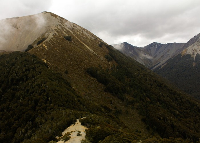
This circuit in Craigieburn Forest Park knits together several different tracks, and visits the summit of Helicopter Hill (1256m).
|
Walking time
|
3 hr |
|---|---|
|
Distance
|
7.5km |
|
Type
|
Loop track
|
|
Grade
|
Easy/medium |
|
Bookings
|
No bookings — open access
No — open access
|
|
Starts
|
Craigieburn Picnic Area, Broken River Ski Area Road, off SH73. |
|---|---|
|
Maps
|
NZTopo50-BW21
|
|
Altitude
|
800m
–
1,256m
Altitude change 456m
|
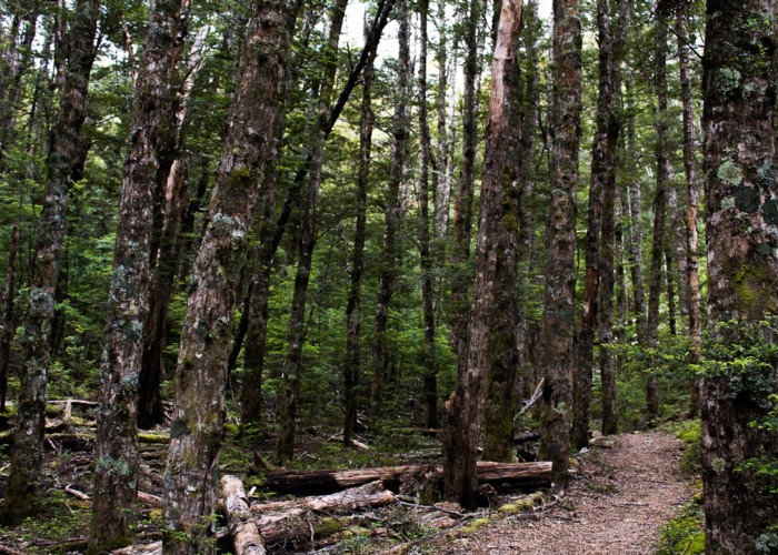
Start this loop from the Craigieburn Picnic Area (camping, toilets, water, shelter). Several tracks on the route are dual use: walking and mountain biking. Take the new Sidle 73 Track through beech and wilding pine forest. It becomes a 4WD track and heads over a scrubland to the Craigieburn Skifield Road.
Head up the road, past several lockable gates to the marked start of the Craigieburn Valley Track. This track pre-dates the road, and was initially the skifield access track. It meanders above the road pleasantly up the valley to a junction just before the valley track crosses a large slip.
Take the marked track to Lyndon Saddle. This is an easy climb through beech then out onto subalpine scrub. The landscape is scattered with wilding pines, although these are being tackled aggressively with aerial spray and chainsaw at present. Just before the saddle, the track climbs into dry beech forest.
From Lyndon Saddle, a track leads to the summit of Helicopter Hill. The route is along the rocky ridgeline, with some easy clambering, then a gentle spiral to the summit, which is cloaked in alpine herbfield.
Back at Lyndon Saddle, take the Mistletoe Track down to the Craigieburn Picnic Area. This is an easy track, and popular with young families.
Walking times from Craigieburn Picnic Area