Nearby
Te Araroa Trail
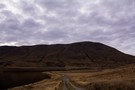
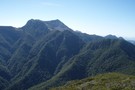
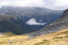
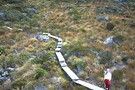
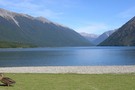
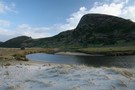
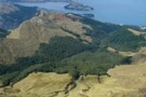
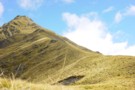
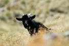
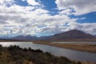
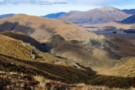
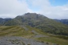
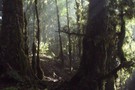
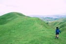
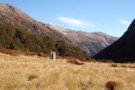
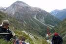
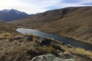
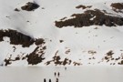
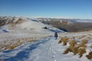
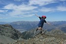
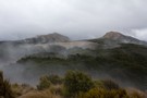
Mount Guy
Track
•
1 day. Medium. Loop track.
•
Distance: less than 100m away
This loop takes in a little mountain and expansive views over Lake Clearwater and the Hakatere Basin.
More ▶︎
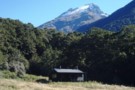
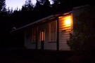
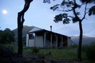
National Park Villiage
Place
•
Place.
•
Distance: less than 100m away
A sleepy ski resort near Tongariro National Park. It is on the main trunk railway line and is home to ...
More ▶︎
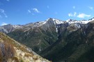
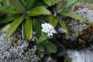
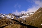
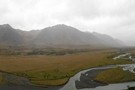
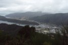
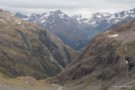
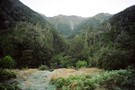
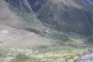
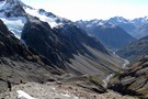
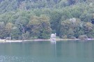
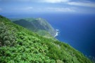
Magdalen Valley
Photograph
•
Distance: less than 100m away
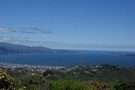
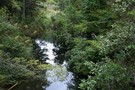
View east over Magdalen Valley to Waiau from Faust
More ▶︎
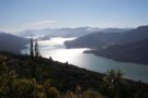
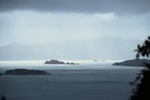
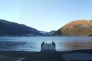
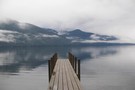
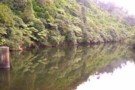
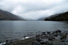
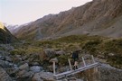
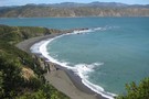
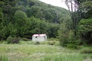
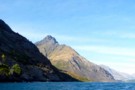
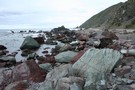
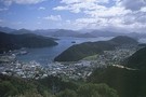
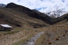
Kenepuru Sound.
Photograph
•
Distance: less than 100m away
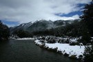
Heading south along the track in the afternoon.Photo of Kenepuru Sound.
More ▶︎
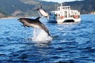
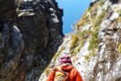
Water taxi on route to Ship Cove
Photograph
•
Distance: less than 100m away
Water taxi on way from Picton to the start of track at Ship Cove, came across some wildlife
More ▶︎

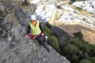
Can you perform while being watched.
Photograph
•
Distance: less than 100m away
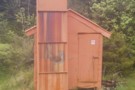
A ready audience for your performance.The Male toilet at the Sofitel Queenstown.
More ▶︎

Can you perform while being watched.
Photograph
•
Distance: less than 100m away
A ready audience for your performance.The Male toilet at the Sofitel Queenstown.
More ▶︎

Who's in your toilet?
Photograph
•
Distance: less than 100m away
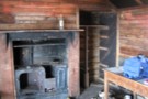
The interior of the Sofitel Hotel in Queenstown Gents toilet
More ▶︎

Who's in your toilet?
Photograph
•
Distance: less than 100m away
The interior of the Sofitel Hotel in Queenstown Gents toilet
More ▶︎
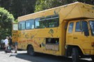
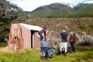
The Auckland University Tramping Club
Club
•
Distance: less than 100m away
This tramping club is run by committed UoA students (who often have a number of other part-time jobs) and supported ...
More ▶︎

The track is booked out? Try TrekWatch.net
Article
•
Distance: less than 100m away
SMS texts directly to your cellphone when a place becomes available. Free of charge!
More ▶︎
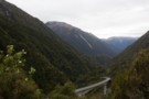
Queen Charlotte Track
Track
•
3 – 5 days. Easy. One way.
•
Distance: less than 100m away
A long but easy walk along Queen Charlotte Sound. This track offers hostel and resort accommodation as well as basic ...
More ▶︎
Hamilton
Place
•
Place. 98.00km2.
•
Distance: less than 100m away
A city south of Auckland, located in the Waikato Region on the banks of the Waikato River. The Pirongia Volcano ...
More ▶︎
Arthur's Pass Village
Place
•
Place.
•
Distance: less than 100m away
Resort village surrounded by mountains within Arthur's Pass National Park.
More ▶︎
Invercargill
Place
•
Place. 491.00km2.
•
Distance: less than 100m away
New Zealand's southernmost and westernmost city, located at the bottom of the South Island on the Southland Plains.
More ▶︎
Auckland
Place
•
Place. 1086.00km2.
•
Distance: less than 100m away
New Zealand's largest city is actually a conurbation of 4 cities and several districts.
More ▶︎
Wellington
Place
•
Place.
•
Distance: less than 100m away
The capital city of New Zealand, located at the southern tip of the North Island.
More ▶︎
Wellington Tramping & Mountaineering Club
Club
•
Distance: less than 100m away
Meets Wednesday Nights at the TTC Clubrooms in Mt Vic.
Has a good variety of trips, from family and daywalks, through ...
More ▶︎
Queenstown
Place
•
Place. 8704.97km2.
•
Distance: less than 100m away
A resort town on Lake Wakatipu in the south of the South Island. The twn is a hub for tourists, ...
More ▶︎
Saint Arnaud
Place
•
Place.
•
Distance: less than 100m away
An alpine village on the shore of Lake Rotoiti in Nelson Lakes National Park.
More ▶︎
Wanganui
Place
•
Place. 2372.66km2.
•
Distance: less than 100m away
A city on the west coast of the North Island at the mouth of the Whanganui River.
More ▶︎
Whangarei
Place
•
Place. 2855.40km2.
•
Distance: less than 100m away
The northernmost New Zealand city, located north of Auckland, in the Bay of Islands, Northland.
More ▶︎
Palmerston North
Place
•
Place. 336.00km2.
•
Distance: less than 100m away
A small city in the Manawatu region north of Wellington.
More ▶︎
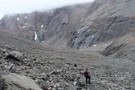
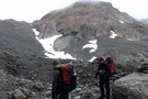
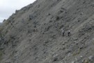
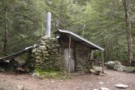
Boyle Village - Mt Faust - Boyle Hut
Track
•
1 day. Medium. One way.
•
Distance: less than 100m away
A great trip over the top of Mt Faust and down a spur to Boyle Hut on the St James ...
More ▶︎

Arthur's Pass National Park
Place
•
National Park. 1145.00km2.
•
Distance: less than 100m away
This alpine park straddles the Main Divide of the Southern Alps, with dry beech forests in the east and damp ...
More ▶︎
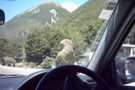
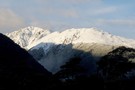
Arthur's Pass Kea
Photograph
•
Distance: less than 100m away
Photogenic Kea on car at Arthur's Pass
More ▶︎
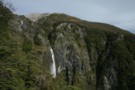
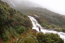
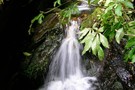
Devil's Punchbowl Walking Track
Track
•
Easy/medium. Return by the same track.
•
Distance: less than 100m away
Classic Arthur's Pass walk to the 131m Punchbowl Falls / Te Tautea o Hinekakai.
More ▶︎
Arthur's Pass Village Historic Walk
Track
•
Easy. Loop track.
•
Distance: less than 100m away
Introductory circuit of the village, providing a history of the Pass and the rail tunnel.
More ▶︎
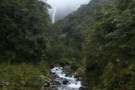
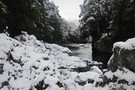
Creek below Devil's Punchbowl Falls.
Photograph
•
Distance: less than 100m away
November 2009.
More ▶︎
Avalanche Peak-Crow River
Track
•
1 – 2 days. Medium. One way.
•
Distance: less than 100m away
A route over Avalanche Peak dropping to the Crow River and exiting down the Waimakariri River.
More ▶︎
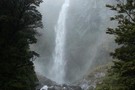
Devil's Punchbowl Falls.
Photograph
•
Distance: less than 100m away
Rainy November day, 2009.
More ▶︎

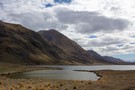
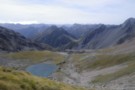
Lake Thompson
Photograph
•
Distance: less than 100m away
A view of the beautiful Lake Thompson, a short distance from Thompson Pass
More ▶︎
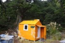
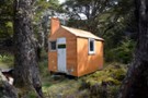
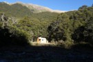
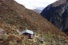
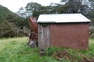
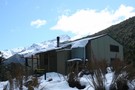
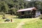
New Porters Creek Hut
Photograph
•
Distance: less than 100m away
moved to spot from right branch wairoa.
has beenlovingly restored with a new lick of 'rescue orange' paint and sports a ...
More ▶︎
Route Guide: Richmond Ranges (west) main ridge
Article
•
Distance: less than 100m away
The main ridge of the western Richmond Ranges from Mt Riley, near Okamario on SH6 to the Red Hills above ...
More ▶︎
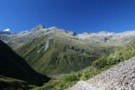
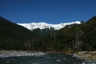
Travers-Sabine Saddle
Photograph
•
Distance: less than 100m away
Going over the saddle looking west towards the Sabine Valley - April 2010.
More ▶︎
Travers-Sabine
Track
•
4 – 7 days. Medium. Loop track with a road section.
•
Distance: less than 100m away
Two river valleys linked by a straightforward alpine saddle at 1800m
More ▶︎

Route Guide: St Arnaud to Lewis Pass
Article
•
Distance: less than 100m away
A 5-7 day north-south route from St Arnaud to the Lewis Pass, via Travers Pass, Waiau Pass, Thompson Pass and ...
More ▶︎

St James Walkway
Track
•
5 days. Easy/medium. One way.
•
Distance: less than 100m away
A long and easy walk on St James Station near Lewis Pass. Beech forest, mountain scenery, farmland, wild horses, mud.
More ▶︎
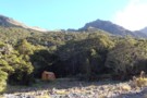
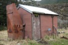
Ada Cullers Hut
Photograph
•
Distance: less than 100m away
Tidy old shack provides shelter and shade from the elements. No mattresses or water supply.
More ▶︎
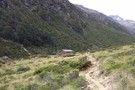
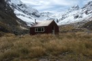
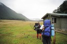
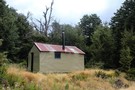
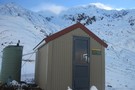
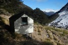
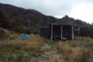
Boyle Flats Hut
Photograph
•
Distance: less than 100m away
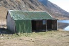
Perched high on a river terrace, accessed from a swingbridge 'on the Boyle'.
More ▶︎
St James Walkway June 2009
Photograph
•
Distance: less than 100m away
Gloriana and the Faerie Queene, on a brilliant winter's day.
More ▶︎
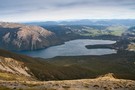
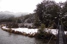
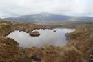
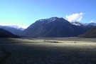
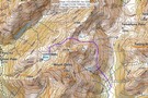
Lake Clearwater village to Mount Guy turn off
Section
•
Distance: less than 100m away
Follow the Lake Clearwater Circuit Track on a 4WD road by the eastern margin of the lake.
More ▶︎
Ninety Mile Beach-Cape Reinga Walkway
Track
•
6 – 8 days. Easy. One way.
•
Distance: less than 100m away
Coastal walking on the northern-most tip of the North Island, visiting Cape Reinga and the entire length of Ninety Mile ...
More ▶︎
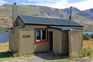
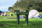
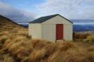
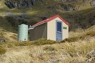
Lake Clearwater Reserve
Campsite
•
Basic Campsite (Not applicable).
•
Distance: 226m away
Campsite and day use area on the banks of Lake Clearwater. There are a number of interesting walks in the ...
More ▶︎
Picton to Aspiring
GPX file
•
Distance: 352m away
An aborted alpine traverse. Picton to West Cape, but aborted at Aspiring due to real world emergencies back home. Posted ...
More ▶︎
Millennium Walk
GPX file
•
Distance: 384m away
Short walk to a waterfall at the Arthur's Pass Visitor Centre.
More ▶︎
Walks Around Arthur's Pass
Article
•
Distance: 399m away
A variety of both easy and more challenging walks are available around Arthur's Pass village and the nearby pass.
More ▶︎
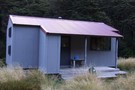
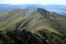
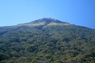
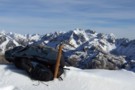
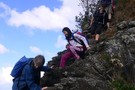
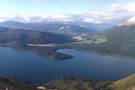
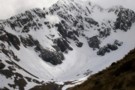
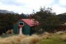
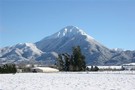
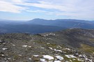
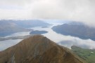
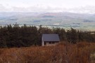
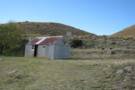
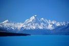
Mount Guy
Photograph
•
Distance: 408m away
This small hill at the foot of Lake Clearwater offers grand views of the mountains to the north and west.
More ▶︎
Queen Charlotte Track
GPX file
•
Distance: 441m away
Queen Charlotte Track over 4 days.
Slight detour to Punga cove accommodation
More ▶︎
day in the sounds
Photograph
•
Distance: 454m away
Looking from mainland to the outer queen charlotte sounds
More ▶︎
d'Arby Falls
Track
•
Easy. Return by the same track.
•
Distance: 454m away
A short walk under palm forest to a waterfall near Ship Cove.
More ▶︎
Cape Jackson
Track
•
2 – 3 days. Easy. Return via same track.
•
Distance: 454m away
A private walk that extends the Queen Charlotte track out to the Cape Jackson lighthouse.
More ▶︎
St Arnaud to Lewis Pass
Track
•
5 – 9 days. Medium/hard. One way.
•
Distance: 458m away
A 5-9 day north-south route from St Arnaud to the Lewis Pass, via Travers Pass, Waiau Pass, Thompson Pass and ...
More ▶︎
Avalanche Creek Shelter campsite
Campsite
•
Basic Campsite (DOC). 10 spaces.
•
Distance: 473m away
Campsite located near the highway in Arthur's Pass Village. A good base for a variety of day walks. The information ...
More ▶︎
Ben Lomond
Track
•
1 day. Medium. Return via same track.
•
Distance: 476m away
A peak behind Queenstown, commanding stunning panoramic views.
More ▶︎
Black Valley Walk
Track
•
Easy. One way.
•
Distance: 592m away
Link track between St Arnaud village and the campground.
More ▶︎
Gibbs Walk
Track
•
Easy. One way.
•
Distance: 628m away
Short link track betweem St Arnaud village and campground.
More ▶︎
Rotorua Tramping & Skiing Club
Club
•
Distance: 644m away
We are an active tramping club with trips most weekends. We also have a lodge on Mt Ruapehu and 2 ...
More ▶︎
Auckland Coast to Coast
Track
•
1 day. Easy. One way.
•
Distance: 735m away
A day walk in an urban jungle Surpriseingly interesting with more wildlife than I have seen in many New Zealand ...
More ▶︎
Walking the length of the Richmond Ranges
Track
•
7 – 14 days. Medium/hard. One way.
•
Distance: 817m away
A 7-14 day walk along the spine of the Richmond Ranges. Alpine tops, crumbling ridgelines, untracked bush & scrub, boulders ...
More ▶︎
Kerr Bay campsite
Campsite
•
Basic Campsite (DOC). 21 spaces.
•
Distance: 845m away
Grassy lakeside camping surrounded by a wealth of walking options, from short walks to alpine tops trips and multi-day tramps. ...
More ▶︎
Tupapakurua Falls
GPX file
•
Distance: 875m away
A nice bush walk near National Park Village. Would make a good alternative to the Tongariro Crossing if the weather ...
More ▶︎
Mavora Lakes Walkways
Track
•
Easy/medium. Return by the same track.
•
Distance: 899m away
A magic place. Think glorious glassy (cold)lake. Reflecting snow covred mountains. Blue sky. Yes I know, all cliches.
More ▶︎
Nelson Lakes - Lakehead, Angelus and Speargrass Circuit
GPX file
•
Distance: 905m away
From St Arnaud along Lake Rotoiti to Lakehead Hut, then crossing the Travers River and via the Cascade Track to ...
More ▶︎
Lake Rotoiti
Photograph
•
Distance: 925m away
from the shore of St Arnaud, looking to the head of the lake and up the Travers Valley - Apr ...
More ▶︎
Loop Track, Lake Rotoiti
Track
•
Easy. Loop track.
•
Distance: 980m away
A short walk through the Rotoiti Nature Recovery Project at St Arnaud. Lakeside beech forest.
More ▶︎
Honeydew Walk, Lake Rotoiti
Track
•
Easy. Loop track.
•
Distance: 980m away
This short loop leads into the edges of the Rotoiti Nature Recovery Project area, a "mainland island" with pest numbers ...
More ▶︎
Auckland Banff Mountain Film Festival
Event
•
24 May 2011 19:30.
•
Distance: 1.1km away
Films from the Banff Mountain Film Festival. Hosted by NZ Alpine Club - Auckland section. Two nights 24/May and 1/June.
More ▶︎
Devil's Punchbowl Track
GPX file
•
Distance: 1.1km away
Short walk to a classic Arthur's Pass waterfall.
More ▶︎
Auckland Banff Mountain Film Festival
Event
•
24 May 2012 19:30 - 29 May 2012 19:30.
•
Distance: 1.1km away
Films from the Banff Mountain Film Festival. Hosted by NZ Alpine Club - Auckland section. Two nights 24/May and 29/May.
More ▶︎
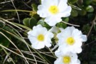
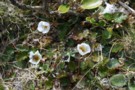
Mountain violet
Photograph
•
Distance: 1.4km away
Viola cunninghamii, Bridal Veil Track, Arthur's Pass.
More ▶︎
March against mining
Event
•
1 May 2010 11:00 - 17:00.
•
Distance: 1.5km away
The Government wants to open up the best of our conservation land to mining...
Will we value and protect our unique ...
More ▶︎
Mount Cassidy
Track
•
1 day. Medium/hard. Return via same track.
•
Distance: 1.5km away
A short but challenging climb from Arthur's Pass Village.
More ▶︎
Lake Emma to Lake Camp
Track
•
Easy. Loop track with a road section.
•
Distance: 1.5km away
Easy day walk across flat country, visiting an historic hut.
More ▶︎
Telford Hut
Hut
•
Basic Hut/Bivvy (DOC). Capacity: 2.
•
Distance: 1.5km away
Biv near the bushline on Telford Burn in the Takitimu Mountains.
More ▶︎
FMC Forever Wild Conference
Event
•
11 June 2011 08:00 - 12 June 2011 16:00.
•
Distance: 1.6km away
In 2011 the presenters include:
* Hon Kate Wilkinson, Minister of Conservation
* Dr Jan Wright, Parliamentary Commissioner for the ...
More ▶︎
Eely Point
GPX file
•
Distance: 1.7km away
Short walk along the Lake Wanaka shoreline from the town centre at Roys Bay to a picnic area at Eely ...
More ▶︎
Pelorus Bridge Trig K
Track
•
Easy. Loop track.
•
Distance: 1.7km away
A walk near the popular Pelorus Bridge. You'll walk in mature lush native bush, along the Pelorus River, and get ...
More ▶︎
Trig K at Pelorus Bridge
Photograph
•
Distance: 1.7km away
Trig K at Pelorus Bridge, DOc time 4 hours return to car park. Fit friend did the loop in 2 ...
More ▶︎
Great mountain buttercup
Photograph
•
Distance: 1.8km away
Ranunculus lyalli. Con's Track, Mount Cassidy, Arthur's Pass.
More ▶︎
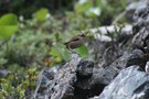
Rock wren
Photograph
•
Distance: 1.8km away
I heard this bird before I saw it, on the scree just above the Con's Track bushline on Mount Cassidy, ...
More ▶︎
Hoarfrost
Photograph
•
Distance: 2.1km away
A shady spot in late Autumn on the Lake George Scott Track behind Lake Tekapo village.
More ▶︎
Anglers Walk, Lake Rotoiti
Track
•
Easy. One way.
•
Distance: 2.2km away
This track follows the first 2km of the Buller River from its source at Lake Rotoiti. It is well used ...
More ▶︎
Schoolhouse Bay campsite
Campsite
•
Backcountry Campsite (DOC). 6 spaces.
•
Distance: 2.2km away
Coastal campsite on the Queen Charlotte Track, located in Resolution Bay, Queen Charlotte Sound.
More ▶︎
Lewis Pass National Reserve
Place
•
Reserve. 182.95km2.
•
Distance: 2.3km away
A small park occupying the forested valleys around Lewis Pass and bordering Lake Sumner and Victoria Forest Parks as well ...
More ▶︎
Tupapakurua Falls
Track
•
0 – 1 day. Easy. Return via same track.
•
Distance: 2.3km away
A nice bush walk near National Park Village. Would make a good alternative to the Tongariro Crossing if the weather ...
More ▶︎
Greta Lodge
Hut
•
Basic Hut/Bivvy (DOC). Capacity: 6.
•
Distance: 2.3km away
This old wooden hut was built during the 1930s, and housed workers on the Glen Lyon Road.
More ▶︎
Arthur's Pass Walking Track
Track
•
Easy. One way.
•
Distance: 2.3km away
A new walk, opened March 2014 to mark 150 years of Arthur's Pass. Attractive and easy walking from the Arthur's ...
More ▶︎
D'Archiac and the Havelock River
Photograph
•
Distance: 2.4km away
Mount D'Archiac (2875m) is 43km away. It lies at the end of the Sibbald Range, just south of the Main ...
More ▶︎
Mount John Walkway
Article
•
Distance: 2.4km away
We had been tramping in New Zealand for 6 months and were starting to feel a bit burnt out. This ...
More ▶︎
Tekapo in gold and blue
Photograph
•
Distance: 2.4km away
The turquoise waters of Lake Tekapo make it one of the most beautiful lakes in New Zealand, especially when framed ...
More ▶︎
West Burn Hut
Hut
•
Basic Hut/Bivvy (DOC). Capacity: 6.
•
Distance: 2.4km away
Small hut on the western shoreline of North Mavora Lake. Note no toilet.
More ▶︎
View from Avalanche Peak June 2013
Photograph
•
Distance: 2.5km away
This pic looks WSW from the summit over the Crow River to Jellicoe Ridge and beyond. The prominent summit on ...
More ▶︎
Mt Bealey - Lyell Peak - Avalanche Peak Traverse
Track
•
1 day. Medium. Loop track.
•
Distance: 2.5km away
A classic traverse from Mt Bealey to Avalanche Peak
More ▶︎
Avalanche Peak
Track
•
Medium. Loop track.
•
Distance: 2.5km away
A day trip near Arthur's Pass village to an altitude of 1833m.
More ▶︎
Rome Ridge - Avalanche Peak Traverse
Track
•
1 day. Medium. Loop track with a road section.
•
Distance: 2.5km away
Climb up Rome Ridge towards Mount Rolleston to traverse the ridge between it and Avalanche Peak.
More ▶︎
Cape Reinga Walkway
Track
•
2 – 3 days. Easy/medium. One way.
•
Distance: 2.7km away
Good coastal tramping and camping at the northern tip of New Zealand.
More ▶︎
Te Paki Coastal Track
Track
•
3 – 4 days. Easy/medium. One way.
•
Distance: 2.7km away
Explore the Far North coastline around Cape Reinga / Te Rerenga Wairua.
More ▶︎
Mt Bealey
Video
•
Distance: 2.7km away
A handy winter day trip from Greymouth view at:
http://www.youtube.com/watch?v=sEhVTeoq9-k
More ▶︎
Shattered rock on Mount Cassidy
Photograph
•
Distance: 2.8km away
The rock is very crumbly and unstable.
More ▶︎
Nelson Lakes National Park
Place
•
National Park. 1017.53km2.
•
Distance: 2.8km away
An alpine park of beech forests, valleys, and glacial lakes, offering some relatively easy walking. Established in 1956. Highest point: ...
More ▶︎
Mount Iron
GPX file
•
Distance: 2.9km away
This classic short walk in Wanaka offers good views of the township. Recorded walking time is toddler-pace.
More ▶︎
Beacon Point
GPX file
•
Distance: 2.9km away
Short walk along the shores of Lake Wanaka from Eely Point to Beacon Point.
More ▶︎
Mt Aicken in Jan
Photograph
•
Distance: 3.0km away
Require Medium fitness level, rock/stone marked track above bushline.
More ▶︎
Whanganui National Park
Place
•
National Park. 742.31km2.
•
Distance: 3.0km away
Lowland forest surrounding the long and sinuous Whanganui River, the longest navigable river in New Zealand. New Zealand's 11th national ...
More ▶︎
Davies Bay campsite
Campsite
•
Backcountry Campsite (DOC). 40 spaces.
•
Distance: 3.0km away
Coastal campsite located in Umungata Bay, in the Grove Arm of Queen Charlotte Sound. This campsite is the last on ...
More ▶︎
Redcliff Valley and hut location
Photograph
•
Distance: 3.0km away
The view from the col between Spence Biv and Redcliff biv. Fiordland ranges and Tuatapere valley in cloud in the ...
More ▶︎
Redcliff Hut / Redcliff Bivouac
Hut
•
Basic Hut/Bivvy (DOC). Capacity: 2.
•
Distance: 3.0km away
A typical 2-bunk forestry service hut in the Takitimus. Situated at the upper forks of the Redcliff Valley this hut ...
More ▶︎
Redcliff Hut /Redcliff Bivouac
Photograph
•
Distance: 3.0km away
A tidy 2-bunk forestry hut in the Takitimus. Great spot, 3-4 visitors per year ... what more can you ask. ...
More ▶︎
Sylvia Flats
Track
•
Easy. Return via same track.
•
Distance: 3.1km away
Roadside hot pools near Lewis Pass
More ▶︎
Sylvia Flats
Campsite
•
Private Hut (Not applicable).
•
Distance: 3.1km away
A marked rest area on SH7 near Lewis Pass, with ample space to stop and camp as well as hot ...
More ▶︎
Moraines below the Dogs Range
Photograph
•
Distance: 3.1km away
Moraines on the glacial till plain that drops from the plateau of the Dogs Range at right. Mystery Lake is ...
More ▶︎
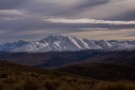
Mount Potts
Photograph
•
Distance: 3.2km away
Mount Potts (2184m) with the Potts River in the foreground. Viewed from Mount Guy.
More ▶︎
Bealey Chasm and Valley
Track
•
Easy/medium.
•
Distance: 3.2km away
A excellent short walk in the autumn or spring with wonderful views of rolleston glacier
More ▶︎
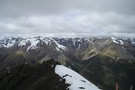
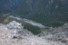
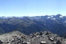
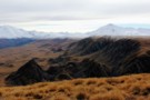
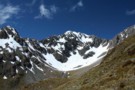
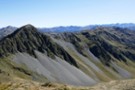
View from Mount Guy
Photograph
•
Distance: 3.3km away
To the left is point 2098 on the Big Hill Range, and the plateau of the Dogs Range.
To the ...
More ▶︎
Tapotupotu Bay
Photograph
•
Distance: 3.4km away
Camping at Tapotupotu Bay on the Cape Reinga walkway. taken October 2005.
More ▶︎
Crow Slide in snow
Photograph
•
Distance: 3.5km away
Frank and me doing an alpine finish (our speciality) down the Crow slide en route to Crow Hut from Avalanche ...
More ▶︎
Pandora Campsite
Campsite
•
Basic Campsite (DOC). 30 spaces.
•
Distance: 3.6km away
Located at Whangākea / Pandora on the Te Paki Coastal Track, and overlooking Waitahora Lagoon.
More ▶︎
Dobson Nature Walk
GPX file
•
Distance: 3.6km away
Stroll through an alpine herbfield scattered with massive boulders, Arthur's Pass National Park.
More ▶︎
Tapotupotu Bay
Photograph
•
Distance: 3.7km away
A beautiful bay just east of Cape Reinga. Road access to a campsite and swimming lagoon.
More ▶︎
Tapotupotu Campsite
Campsite
•
Standard Campsite (DOC). 45 spaces.
•
Distance: 3.7km away
Coastal camping at the country's most northerly campsite.
This campsite has a boatramp and cold showers. It is wheelchair accessible, ...
More ▶︎
Manawatu Riverside Walkway & Bridle Track
Track
•
Easy. One way.
•
Distance: 3.8km away
Manawatu Riverside Walkway & Bridle Track
More ▶︎
Mingha River-Deception River
Track
•
2 days. Medium. One way.
•
Distance: 4.0km away
Goat Pass Track. Alpine track over a pass between two river valleys.
More ▶︎
Paddy's Pinchgut circuit
Track
•
Easy. Loop track.
•
Distance: 4.0km away
Mt Robert carpark to carpark via Paddy Track, Bushline hut, Relax Shelter and Pinchgut track - 4 hours. 575m up ...
More ▶︎
Paddy's Pinchgut circuit
Photograph
•
Distance: 4.0km away
Great morning or afternoon walk with great lake and mountain views.
More ▶︎

Profile : St Arnaud - Lewis Pass
Photograph
•
Distance: 4.1km away
A useful profile of the 100km tramp - with a couple of bad weather alternatives :
1. low route past Speargrass ...
More ▶︎

St Arnaud - Lewis Pass
Article
•
Distance: 4.1km away
A 9-day 100km tramp via the Thompson, D'Urville and 3 Tarns Passes
Feb 2013
More ▶︎
Crow Hut (Arthur's Pass)
Hut
•
Standard Hut (DOC). Capacity: 10.
•
Distance: 4.1km away
In the Crow valley, Arthur's Pass National Park.
More ▶︎
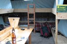
Crow hut (Arthurs Pass) March 2008
Photograph
•
Distance: 4.1km away
I've noticed that there isn't a photo on here of this hut to go with the text entry. Seeing no ...
More ▶︎
Lake Misery Track
GPX file
•
Distance: 4.1km away
Short connector track that crosses the Main Divide of the Southern Alps.
More ▶︎
Boyd Creek to The Divide via Kiwi Burn and the Mavora Walkway
Article
•
Distance: 4.1km away
A New Year's trip through the Snowdon Forest and on to The Divide. Heavily affected by weather, I had to ...
More ▶︎
Careys Hut
Hut
•
Standard Hut (DOC). Capacity: 7.
•
Distance: 4.1km away
Hut at the head of North Mavora Lake on the Mavora-Greenstone Walkway. This corrugated iron hut includes both a coal ...
More ▶︎
Mt Rolleston- Low Peak (via Rome ridge)
Track
•
Medium/hard.
•
Distance: 4.1km away
Track starts off at SH73 (Coral track). Steep ascent through the bush line on a marked track leading you up ...
More ▶︎
Twilight Campsite
Campsite
•
Basic Campsite (DOC). 25 spaces.
•
Distance: 4.1km away
Overlooking Paengarēhia / Twilight Beach, this campsite is located on the Te Paki Coastal Track.
More ▶︎
Tupapakurua Falls
Photograph
•
Distance: 4.2km away
The best view of the falls is from the lookout atthe top of the bluff
More ▶︎
The bottom of Tupapakurua Falls
Photograph
•
Distance: 4.2km away
If you are brave you can go to the bottom of the falls. It is a wet and slippery experience.
More ▶︎
Ben Lomond Station Guided Walk
Track
•
2 days. Easy. Pickup from central Queenstown.
•
Distance: 4.2km away
2 day guided walk near Queenstown, highlighting the local gold mining history
More ▶︎
Temple Basin Ski Field
Photograph
•
Distance: 4.2km away
Taken a little past the ski huts, November 2012
More ▶︎
Temple Basin
Track
•
Easy/medium. Return via same track.
•
Distance: 4.2km away
A steepish climb through alpine meadows to the Temple Basin skifield
More ▶︎
Lake Middleton Campground
Campsite
•
Great Walks Campsite (Private).
•
Distance: 4.2km away
Camp under trees by Lake Middleton, a kettle lake next to Lake Ohau. The campsite offers flush toilets and campervan ...
More ▶︎

Edwards River-Hawdon River
Track
•
3 days. Medium. One way.
•
Distance: 4.3km away
See Hawdon River.
More ▶︎
Dobson Nature Walk
Track
•
Easy. One way.
•
Distance: 4.4km away
A short walk on the Main Divide of the Southern Alps, offering alpine flora and panoramic views.
More ▶︎
Lake Mavis
Track
•
2 days. Medium. Return via same track.
•
Distance: 4.4km away
A side trip off the popular Mingha-Deception route in Arthur's Pass.
More ▶︎
Rakaia Gorge Walkway
Track
•
Easy. Return via same track.
•
Distance: 4.4km away
Following the edge of the Rakaia Gorge, this track crosses volcanic lava flows and provides panoramic views of the river ...
More ▶︎
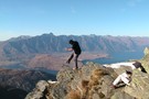
View from Ben Lomond
Photograph
•
Distance: 4.5km away
The view from the summit of Ben Lomond is precipitous. Double Cone (2319m) and the Remarkables Range in the distance; ...
More ▶︎
Ben Lomond Summit
Photograph
•
Distance: 4.5km away
This pic was taken in Fall 2007. Was a great summit day - only saw one other person the entire ...
More ▶︎
Ben Lomond
Photograph
•
Distance: 4.5km away
Ben Lomond is located immediately behind Queenstown, on Lake Wakatipu. Photographed from Bowen Peak.
More ▶︎
Ascending Ben Lommond in winter
Photograph
•
Distance: 4.5km away
August 2009 and lots of ice on the track. We were able to widen it a little with snowshoes and ...
More ▶︎
The summit of Ben Lommond
Photograph
•
Distance: 4.5km away
Near to Queenstown. A few hours walk to the top of Ben Lommond.
At around 1900M the view to the ...
More ▶︎
St Arnaud Range Track
Track
•
1 day. Medium. Return by the same track.
•
Distance: 4.5km away
This walk climbs steadily through beech forest to a height of over 1650 metres.
Above the bushline (at 1400 m), ...
More ▶︎
Auckland tramping Club
Club
•
Distance: 4.5km away
A very actice club includes a youth group and vets group. Day hikes Sundays & Wednesdays. Monthly weekend tramps and ...
More ▶︎
Mount Somers looking north
Photograph
•
Distance: 4.5km away
The south face is steep and eroded. From the west, a gentle plain rises to the summit.
More ▶︎
Bowen Peak
Track
•
Easy/medium. Return via same track.
•
Distance: 4.5km away
A grassy peak neighbouring Ben Lomond behind Queenstown.
More ▶︎
Page Memorial Shelter
Photograph
•
Distance: 4.6km away
Day shelter in Temple Basin, Arthurs Pass.
Page Memorial Shelter is little day-hut built for skiers in Temple Basin, set apart ...
More ▶︎
Lake Middleton
Track
•
Easy. Loop track.
•
Distance: 4.7km away
An unmarked circuit of this tiny kettle lake next to Lake Ohau. Mountain and lake views.
More ▶︎
Bushline Hut
Hut
•
Standard Hut (DOC). Capacity: 14.
•
Distance: 4.7km away
A cute hut with a grand outlook over Lake Rotoiti and down to St Arnaud. Loo with a view!
More ▶︎
Parachute Rocks Track
Photograph
•
Distance: 4.8km away
View of Lake Rotoiti from point 1738
More ▶︎
Greyneys campsite
Campsite
•
Informal campsite (DOC). 10 spaces.
•
Distance: 4.8km away
A grassy clearing in the forest next to the highway, with a stone shelter. This campsite is located near the ...
More ▶︎
Lake Sumner Conservation Park
Place
•
Conservation Park. 1057.71km2.
•
Distance: 4.8km away
Lakes and forested hills in this sprawling park provide good tramping, and contrast with the rugged alpine environment of Arthur's ...
More ▶︎
Nina River
Track
•
2 days. Easy. Return by the same track.
•
Distance: 4.8km away
Easy tramping up a pretty river valley near Lewis Pass.
More ▶︎
Greyneys Shelter June 2012
Photograph
•
Distance: 4.9km away
This shelter is next to SH 73 between Arthur's Pass Village and the Waimakariri River at Klondyke Corner. It's handy ...
More ▶︎
Lake Misery Track
Photograph
•
Distance: 4.9km away
Small rockpile on the Lake Misery Track.
More ▶︎
Kea hut
Hut
•
Private hut (NA).
•
Distance: 4.9km away
An older but lovingly restored hut in the Mt Robert area of Nelson Lakes National Park. This hut is only ...
More ▶︎
Kea hut Nov 2012
Photograph
•
Distance: 4.9km away
An older but lovingly restored hut in the Mt Robert area of Nelson Lakes National Park. This hut is only ...
More ▶︎
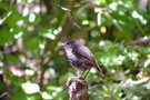
North Island Robin
Photograph
•
Distance: 5.0km away
Taken on Matiu Somes Island DOC Reserve, Wellington Harbour.
More ▶︎
Upper Wairaki Hut
Hut
•
Basic Hut/Bivvy (DOC). Capacity: 2.
•
Distance: 5.0km away
Located at the treeline below Bull Basin in the Takitimu Mountains. Takitimu Conservation Area.
More ▶︎
Mt Philistine Traverse
Track
•
1 day. Hard. One way.
•
Distance: 5.0km away
A classic mountain traverse in Arthurs Pass National Park, includes climbing steep scree, bluffs, rock and snow. An ice axe ...
More ▶︎
Upper Wairaki Hut
Photograph
•
Distance: 5.1km away
2 bunk biv located in the Takitimu Mountains.
More ▶︎
Relax Shelter
Hut
•
Shelter (DOC).
•
Distance: 5.1km away
Basic shelter on Robert Ridge (Mt Robert, Nelson Lakes National Park)
More ▶︎
Relax Shelter Nov 2012
Photograph
•
Distance: 5.1km away
On the Pinchgut track Mt Robert close to the junction with Paddys track and the Robert Ridge route.
More ▶︎
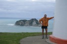
Via Ferrata in Queenstown
Photograph
•
Distance: 5.2km away
When you've got time to kill in QT, take half a day to try the Via Ferrata experience. Simple and ...
More ▶︎
Winton Burn and Mararoa from Mavora Walkway
Photograph
•
Distance: 5.2km away
Wind and rain swept vista from the bluffs above Careys hut on route to Boundary hut. The gully to the ...
More ▶︎
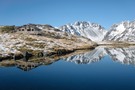
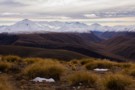
Lake Emma
Photograph
•
Distance: 5.3km away
Mount Potts (2194m) and Mount Guy beyond (1322m).
More ▶︎
Freehold Creek
Track
•
1 day. Medium. Return by the same track.
•
Distance: 5.3km away
Climb the mountains behind Lake Ohau into a basin of tarns and waterfalls.
More ▶︎
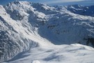
Crow Glacier, Mt Rolleston
Photograph
•
Distance: 5.4km away
Crow glacier and Mt Rolleston. taken April 1969.
More ▶︎
Mephistopheles
Photograph
•
Distance: 5.4km away
One of the named peaks along the Libretto Range, which runs from Lewis Pass to Boyle Village.
The ridge to Faust ...
More ▶︎
Nina River First Swing Bridge ~ Snowy
Photograph
•
Distance: 5.4km away
The first swing bridge, in winter, gorgeous
More ▶︎
Hakatere Conservation Park
Place
•
Conservation Park. 600.00km2.
•
Distance: 5.5km away
This park protects high country between the Rakaia and Rangitata Rivers in the Ashburton Lakes District, Mid-Canterbury.
More ▶︎
North Shore Tramping Club
Club
•
Distance: 5.5km away
Based in Auckland, New Zealand, the North Shore Tramping Club is a friendly club offering a wide range of trips, ...
More ▶︎
North Mavora Lake
Photograph
•
Distance: 5.6km away
The view up the North Mavora from near the boat ramp at the southern end of the lake on a ...
More ▶︎
Mingha Biv
Photograph
•
Distance: 5.7km away
The old and not in very good condition Mingha Biv
More ▶︎
Mingha Biv
Hut
•
Basic Hut/Bivvy (DOC). Capacity: 2.
•
Distance: 5.7km away
Just south of Goat Pass. Hut has had a full refurbishment thanks to NZDA, Permolat and The Back Country Trust. ...
More ▶︎
Mt Guy from the Dogs Range
Photograph
•
Distance: 5.7km away
Here's a photo from the dogs range , In the fore front are rock drumlins ( I think ) and ...
More ▶︎
Devils Rampart
Photograph
•
Distance: 5.7km away
from the Sylvia tops, the Devils Rampart is slowly revealed as the mists begin to lift - Feb 2018
More ▶︎
Otira Valley
Track
•
Easy. Return via same track.
•
Distance: 5.7km away
A short, pretty walk into an alpine environment. A variety of alpine flowers in summer.
More ▶︎
Mt Rolleston - Otira Face
Photograph
•
Distance: 5.7km away
The best known peak in Arthurs Pass national park. The Otira Face as seen here from Mt Philistine is often ...
More ▶︎
Lake Emma Hut
Photograph
•
Distance: 5.7km away
Lake Emma Hut with the Clent Hills and Mount Taylor (2330m) beyond.
More ▶︎
Lucretia Hut Route
Track
•
1 day. Easy/medium. Return by the same track.
•
Distance: 5.8km away
Lucretia biv via Nina Valley
More ▶︎
Lewis River
Photograph
•
Distance: 5.8km away
Lewis River near Palmer Lodge at the start of the Nina Valley Track, October 2009.
More ▶︎
Lake Emma hut
Hut
•
Shelter (DOC).
•
Distance: 5.8km away
An historic corrugated iron hut on the shoreline of Lake Emma. The hut is thought to date from the 1880s, ...
More ▶︎
Route Guide: Richmond Ranges (east)
Article
•
Distance: 5.8km away
Tramping in the eastern Richmond Ranges between Picton and Okaramio (SH6)
More ▶︎
Hauhungatahi Track
GPX file
•
Distance: 5.9km away
Hauhungatahi, also called Baldy, is the prominent hill just outside National Park. It is in a remote experience zone so ...
More ▶︎
Hauhungatahi Track
Track
•
1 day. Easy/medium. Return by the same track.
•
Distance: 5.9km away
Hauhungatahi, also called Baldy, is the prominent hill just outside National Park. It is in a remote experience zone so ...
More ▶︎

Lake Emma and hut
Photograph
•
Distance: 6.0km away
Tucked into the flanks of Mount Harper, Lake Emma Hut sits on the shore of the lake. The historic farm ...
More ▶︎
Philistine / Warnock's Bluffs
Photograph
•
Distance: 6.2km away
The normal route up Philistine from the road ascends through this line of bluffs. When there is no snow, the ...
More ▶︎
Mount Barron
Photograph
•
Distance: 6.2km away
Mount Barron from the Death's Corner lookout. The route follows the far edge of the obvious slip. The steep bluffs ...
More ▶︎
Puke Ariki Track
Track
•
1 day. Easy/medium. One way.
•
Distance: 6.2km away
A long traverse of Belmont Regional Park near Wellington. Hilly farmland, harbour views, explosives magazines, and native forest.
More ▶︎
Belmont Regional Park
Place
•
Local Park or Reserve. 36.91km2.
•
Distance: 6.2km away
A forested plateau between Lower Hutt and Porirua Harbour. The park is managed by the Greater Wellington Regional Council.
More ▶︎
Spence Hut / Spence Burn Bivouac
Hut
•
Standard Hut (DOC). Capacity: 2.
•
Distance: 6.3km away
Spence Hut is a typical 2-bunk Takitimu hut. It lies at the forks of Spence Stream close to the bushline, ...
More ▶︎
Spence Hut
Photograph
•
Distance: 6.3km away
A typical 2-bunk forestry hut in the Takitimus:
- A good weekend in-out walk from the Dunrobin Roadend
- A 2-3 day ...
More ▶︎
Mt Hauhungatahi (Baldy)
GPX file
•
Distance: 6.3km away
Although meandering in some places, these GPX coordinates should get you up and down Mt Hauhungatahi (Baldy) without too much ...
More ▶︎
Breaker Bay to Ataturk - GE overview
Photograph
•
Distance: 6.4km away
GPS track overlaid on Google Earth image
More ▶︎
Breaker Bay to Ataturk Memorial
Track
•
Easy. Loop track with a road section.
•
Distance: 6.4km away
An easy walk along cliffs above Breaker Bay to the Ataturk Memorial and return along the beach. Great views from ...
More ▶︎
Matiu-Somes Island
Track
•
Easy. Loop track.
•
Distance: 6.4km away
Easy walk around DOC reserve island in the middle of Wellington Harbour. Home to tuatara, skink, gecko and several endangered ...
More ▶︎
Forest and Bird House
Hut
•
Private hut (Royal Forest & Bird Society). Capacity: 8.Bookings required.
•
Distance: 6.5km away
A sole-occupancy lodge on Matiu / Somes Island in Wellington Harbour. The house was built as part of a maximum ...
More ▶︎
A rather damp track on Hauhungatahi
Photograph
•
Distance: 6.6km away
The track above bushline on Hauhungatahi has no shortage of water on it
More ▶︎
Belmont Trig & Korokoro Dam, Loop
Track
•
0 – 1 day. Easy/medium. Loop track.
•
Distance: 6.7km away
Loop track up Belmont Trig, down to Korokoro Dam and back to Stratton Street.
Belmont Trig: 458m (1503feet), Total loop track ...
More ▶︎
Harman Pass - Taipo River - Kelly Saddle
Track
•
3 – 5 days. Medium/hard. One way.
•
Distance: 6.7km away
A long journey through the west of Arthur's Pass National Park.
More ▶︎
Sylvia tops
Photograph
•
Distance: 6.7km away
on the Sylvia tops and in the clag as we contoured around the north side of SH1662 - Feb 2018
More ▶︎
Edwards Hut
Hut
•
Serviced Hut (DOC). Capacity: 16.
•
Distance: 6.7km away
Well built hut, sleeps 16 people.
More ▶︎
Edwards Hut Toilet
Photograph
•
Distance: 6.7km away
View down the valley from the Edwards hut.
More ▶︎
Klondyke Corner campsite
Campsite
•
Informal campsite (DOC). 30 spaces.
•
Distance: 6.7km away
A large grassy site often used as a base for trampers in the area. The area features a striking octagonal ...
More ▶︎
Klondyke shelter and campsite
Photograph
•
Distance: 6.8km away
The striking octagonal shelter by the roadside, and camping area beyond.
More ▶︎
Queen Charlotte Track connector
GPX file
•
Distance: 6.8km away
Links Onahau Road with the Peninsula Walk near Mistletoe Bay.
More ▶︎
Head of the Rolleston River, just below Pt2000
Photograph
•
Distance: 6.8km away
Taken while traversing slopes high in the Rolleston river. Shows the snow slope used to access the first col north ...
More ▶︎
Ayres Hut (Removed)
Hut
•
Removed!
•
Distance: 6.8km away
Restored 4 bunk hut one hour up Black Birch Stream, Mesopotamia, in Two Thumb Range. As of 2012, DOC reports ...
More ▶︎
Mount Richmond Forest Park
Place
•
Conservation Park. 1660.00km2.
•
Distance: 6.9km away
A wedge of land at the base of the Marlborough Sounds, south of Nelson and north of the Wairau River, ...
More ▶︎
Hauhungatahi Wilderness Area
Place
•
Wilderness Area. 84.98km2.
•
Distance: 7.0km away
Forested and alpine western slopes of Mount Ruapehu within Tongariro National Park, including the small volcanic remnant, Hauhungatahi (1521m).
More ▶︎
Waimakariri Falls Hut
Hut
•
Basic Hut/Bivvy (Canterbury Mountaineering Club). Capacity: 6.
•
Distance: 7.1km away
Located in the Waimakariri headwaters at 1300m, just above the top falls. Built 1960, and refurbished 2005.
More ▶︎
Above Waimakariri Falls
Photograph
•
Distance: 7.1km away
Looking down the valley from high under Waimak Col. Spot the hut? (just left of the river - the new ...
More ▶︎
Mistletoe Bay Eco Village
Campsite
•
Standard Campsite (Private). 42 spaces.
•
Distance: 7.1km away
This private campsite offers ample coastal camping space along with backpacker-style accommodation. Campers have access to a new camp kitchen ...
More ▶︎
Goat Pass Hut
Hut
•
Standard Hut (DOC). Capacity: 20.
•
Distance: 7.1km away
Large hut on the popular Mingha-Deception route
More ▶︎
Philistine Bluffs
Photograph
•
Distance: 7.1km away
Decending the bluffs - not a forgiving place to loose your footing- there have been deaths here.
More ▶︎
Philistine Bluffs
Photograph
•
Distance: 7.1km away
Decending the bluffs - not a forgiving place to loose your footing- there have been deaths here.
More ▶︎
Mt Philistine
Track
•
1 day. Medium/hard. Return via same track.
•
Distance: 7.1km away
Moderate to hard daytrip in Arthurs Pass.
More ▶︎
Sledge Track
Track
•
1 day. Easy/medium. Loop track.
•
Distance: 7.2km away
Easy to Medium Track through the Kahuterawa Valley along the Kahuterawa Stream and up to Hardings Park.
More ▶︎
Harper Pass - Kiwi Saddle
Track
•
5 – 7 days. Medium. One way.
•
Distance: 7.2km away
A classic crossing of the Main Divide, following the deep valleys of the Hope Fault from the Arthur's Pass road ...
More ▶︎
Hope-Kiwi Lodge
Track
•
2 days. Easy. Return via same track.
•
Distance: 7.2km away
Easy but dull walking along the Hope River, following the line of the Hope Fault. From the spacious hut, you ...
More ▶︎
Queen Charlotte Track connector
GPX file
•
Distance: 7.3km away
Links the Queen Charlotte and James Vogel Tracks, leading down to Mistletoe Bay.
More ▶︎
Te Kahui Kaupeka Conservation Park
Place
•
Conservation Park. 938.00km2.
•
Distance: 7.3km away
Canterbury high country park including the Two Thumb Range and large portions of Mesopotamia Station.
More ▶︎
Climbing above Devilskin Saddle
Photograph
•
Distance: 7.3km away
day triping up from the Devilskin Saddle Hut June 2010. (lewis pass)
See hut and toilet on the saddle below.
Also see ...
More ▶︎
Waimakariri River-Rolleston River
Track
•
2 – 3 days. Hard. One way.
•
Distance: 7.4km away
Alpine tramp over Waimakariri Col.
More ▶︎
Three Passes
Track
•
4 – 5 days. Medium/hard. One way.
•
Distance: 7.4km away
A classic trip from Arthur's Pass across Browning, Whitehorn and Harman Passes, emerging near Lake Kaniere on the West Coast.
More ▶︎
Barker Hut
Track
•
2 – 3 days. Medium. Return by the same track.
•
Distance: 7.4km away
Surrounded by glaciers at the head of the White River, this is the highest hut in Arthur's Pass National Park.
More ▶︎
The Trail Klondyke Corner to Carrington Hu
Photograph
•
Distance: 7.4km away
view of the grassy trail before the riverbed becomes the trail.
The hut is still far here but it is behind ...
More ▶︎
Other Part of trail to Carrington Hut
Photograph
•
Distance: 7.4km away
the trail after a nice rain
More ▶︎
The Track Starts
Photograph
•
Distance: 7.4km away
After three or four scree/shrub combinations, where the gorge below opens out a little, keep an eye out for the ...
More ▶︎
Track Descent
Photograph
•
Distance: 7.4km away
The map shows the track crossing two small tributaries before heading sharply down to meet the main river. You may ...
More ▶︎
Pick Your Path
Photograph
•
Distance: 7.4km away
Try to stay reasonably high above the river on the true left for the easiest route down and to avoid ...
More ▶︎
Grass my Arse
Photograph
•
Distance: 7.4km away
Sections of alpine "herbs" break up the scree slopes high above the Rolleston River. There is no track through these ...
More ▶︎
At the top
Photograph
•
Distance: 7.4km away
If intending to cross over into the Rolleston from the Waimak, DON'T go over the actual Waimak Col (you'll see ...
More ▶︎
Top of Rolleston Valley
Photograph
•
Distance: 7.4km away
There are sporadic cairns down into the Rolleston Valley, but they can be difficult to pick out against the scree. ...
More ▶︎
Waimakariri River flats
Photograph
•
Distance: 7.4km away
Starting out from the East Coast, the Waimakariri River is a long but easy slog to Carrington Hut. Follow the ...
More ▶︎
Route Planning
Photograph
•
Distance: 7.4km away
Checking the map for a route over the head of the Waimakariri Valley into the Rolleston Valley. Be aware in ...
More ▶︎
Puke Ariki farmland
Photograph
•
Distance: 7.4km away
The northern section of Puke Ariki Track in Belmont Regional Park is over exposed farmland.
More ▶︎
Scree traverse
Photograph
•
Distance: 7.5km away
a long traverse on virgin scree high above Devilskin saddle - Feb 2018
More ▶︎
Belmont Trig & Korokoro Dam, Loop
GPX file
•
Distance: 7.5km away
Loop from Stratton Street up to Belmont Trig, then to Korokoro Dam and back to Stratton Street
More ▶︎
Devilskin Saddle
Photograph
•
Distance: 7.7km away
Devilskin Saddle between the Nina and Doubtful Valleys off the Lewis Pass. March 2007.
More ▶︎
Dog Hill to Boundary Creek Hut
Photograph
•
Distance: 7.8km away
From Buicks bridge car park their is a 4WD track (4.24km ) running to the bace of dog hill , ...
More ▶︎
Anti Crow Hut
Hut
•
Standard Hut (DOC). Capacity: 6.
•
Distance: 7.8km away
In the Waimakariri valley near Anti Crow River.
The previous Anti Crow Hut used to be the CMC hut about half ...
More ▶︎
Upper Deception Hut
Hut
•
Basic Hut/Bivvy (DOC). Capacity: 6.
•
Distance: 7.8km away
Six bunk hut adjacent the popular Mingha-Deception route. It was built by the NZFS in 1962.
[A four bunker Lower Deception ...
More ▶︎
Upper Deception hut Feb 2009
Photograph
•
Distance: 7.8km away
A sound old NZFS hut in need of a bit of TLC. The scrub badly needed cutting back last time ...
More ▶︎
Near Devilskin Saddle
Photograph
•
Distance: 7.8km away
Fresh snow in the beech forest northeast of Devilskin Saddle. October 2009.
More ▶︎
Mystery Lake Track
Track
•
1 – 2 days. Easy. Loop track.
•
Distance: 7.8km away
Circuit track to a small tarn in the Ashburton Lakes.
More ▶︎
route from Lake Mavis to Edwards Valley bypassing Taruahuna Pass
Photograph
•
Distance: 7.8km away
This route bypasses the pass with its tiresome talus travel for those who have experienced it several times already!
More ▶︎
Nina Hut
Hut
•
Standard Hut (DOC). Capacity: 10.
•
Distance: 7.8km away
Replacing the old hut down by the river, this hut is located in an elevated clearing with good mountain views. ...
More ▶︎
Snow, old Devil's Den Hut site
Photograph
•
Distance: 7.8km away
The old hut site was at the treeline east of Devilskin Saddle. After an avalanche, a new hut was built ...
More ▶︎
Robert Ridge
Photograph
•
Distance: 7.8km away
looking down the ridge from Flagtop - Apr 2011
More ▶︎
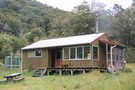
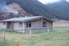
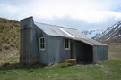
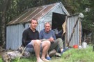
Magdalen Hut 2011
Photograph
•
Distance: 7.9km away
Magdalen Hut is on the Boyle River. 15 to 20 minutes downstream from the swingbridge between Boyle Flats Hut and ...
More ▶︎
Devils Den Bivouac
Hut
•
Basic Hut/Bivvy (DOC). Capacity: 2.
•
Distance: 7.9km away
Devils Den / Devilskin bivouac (2 beds) is a brand new bivouac ABOVE Devilskin Pass. Built in 2008, this new ...
More ▶︎
Doubtful Hut
Photograph
•
Distance: 7.9km away
Old timer shack with 3-4 bunks near the Doubtful River, Northern Canterbury.
More ▶︎
Devils Den Bivouac
Photograph
•
Distance: 7.9km away
Devils Den Bivouac, below Devilskin Saddle between the Nina and Doubtful valleys. March 2007 - 3 feet of snow on ...
More ▶︎
Magdalen Hut
Hut
•
Standard Hut (DOC). Capacity: 6.
•
Distance: 7.9km away
Magdalen Hut is the 3rd incarnation on this paddock. Built in 2008, it's sparky and shiny, with 6 bunks.
More ▶︎
Pakituhi Hut
Hut
•
Standard Hut (DOC). Capacity: 8.
•
Distance: 7.9km away
A new, but characterless tramping hut 1000m above Lake Hawea. 8 mattresses on 2 sleeping platforms. Tank water. No fire.
...
More ▶︎
Pakituhi Hut
Photograph
•
Distance: 7.9km away
The new Pakituhi Hut, above Lake Hawea. An overnighter with a 1.5-3 hrs climb up the 1000m from the lakeside ...
More ▶︎
Lake Hawea from above Pakituhi Hut
Photograph
•
Distance: 7.9km away
Views up Lake Hawea from the ridgeline 5 mins above Pakituhi hut.
More ▶︎
Devilskin Saddle
Photograph
•
Distance: 8.1km away
from the saddle, the new biv is 50m west towards the Devils Rampart. (photo taken Feb 2018)
More ▶︎
Kaipupu Wildlife Sanctuary
GPX file
•
Distance: 8.1km away
Short loop track exploring the predator-fenced reserve.
More ▶︎
Devils Den Bivouac above Devilskin Pass
Photograph
•
Distance: 8.1km away
Built in 2008, this is, perhaps, the bestest and newest little hut in NZ.
More ▶︎
Devils Den Bivouac
Photograph
•
Distance: 8.1km away
Built in 2007 to replace the old version which was below Devilskin Saddle by the bushline. This new, sparkly version ...
More ▶︎
New Devils Den Bivvy Location
GPX file
•
Distance: 8.2km away
A GPX file of the new bivvy located on Devilskin Saddle.
The old Devils Den Bivvy has been removed.
More ▶︎
Crooked Spur Hut
Hut
•
Basic Hut/Bivvy (DOC). Capacity: 8.
•
Distance: 8.2km away
A beech-pole hut constructed 1947, and located about 1 hour's climb above the streambed of Bush Stream near Mesopotamia. Used ...
More ▶︎
Doubtful Hut
Hut
•
Basic Hut/Bivvy (DOC). Capacity: 2.
•
Distance: 8.3km away
This hut sits just outside of Lake Sumner Conservation Park in the Doubtful River valley. Rather old and unappealing. Plenty ...
More ▶︎
Doubtful Hut
Photograph
•
Distance: 8.3km away
A good spot for a snack on the way up to Lake Man!
More ▶︎
East Cape to West Cape - the length of NZ's main divide
Track
•
125 – 300 days. Hard. One way.
•
Distance: 8.3km away
A guide to my route from East Cape to West Cape, the length of NZ's main divide.
More ▶︎
Lewis Tops from from Nina Hut
Photograph
•
Distance: 8.3km away
The view north from Nina Hut, March 2007
More ▶︎
Nina Hut at Night
Photograph
•
Distance: 8.3km away
This hut is situated in a superb location, with wide views up all the valleys around it. A good move, ...
More ▶︎
Nina Hut Views
Photograph
•
Distance: 8.3km away
Windows in the new Nina Hut are well set up for admiring the views.
More ▶︎
Walter Peak
Track
•
1 day. Medium. Return via same track.
•
Distance: 8.3km away
Walter Peak is the prominent peak on the other side of Lake Wakatipu, where the Earnslaw boat goes.
Most of the ...
More ▶︎
Coldwater hut
Hut
•
Standard Hut (DOC). Capacity: 12.
•
Distance: 8.4km away
A concrete hut with 12 bunks. When I was there during the Summer the fire had been removed to prevent ...
More ▶︎
Coldwater Hut
Photograph
•
Distance: 8.4km away
The hut, from the Lakehead jetty, looking across Lake Rotoiti - Apr 2011
More ▶︎
Camp Bay campsite
Campsite
•
Basic Campsite (DOC). 20 spaces.
•
Distance: 8.4km away
Coastal campsite located in Camp Bay, Endeavour Inlet, Queen Charlotte Sound. This campsite sits beneath Kenepuru Saddle on the Queen ...
More ▶︎
Red Rocks
Track
•
Easy. Return via same track.
•
Distance: 8.4km away
A Wellington coastal walk to a rocky outcrop and seal colony.
More ▶︎
Boyle Flats Hut
Hut
•
Serviced Hut (DOC). Capacity: 20.
•
Distance: 8.5km away
Perched high above the river on a grassy bench, Boyle Flats Hut is accessed via a swingbridge over the Boyle.
More ▶︎
St James Conservation Area
Place
•
Place. 781.96km2.
•
Distance: 8.5km away
A large new recreational area featuring tussock grasslands, and including the headwaters of the Waiau and Clarence Rivers.
More ▶︎
Maitland River
Photograph
•
Distance: 8.5km away
Descent of the Maitland from the hut to the roadend via the river involves over 20 crossings. Good fun on ...
More ▶︎
Hawea Solitude
Article
•
Distance: 8.5km away
Who would have thought you could have huts to yourself on a long weekend within an hour’s drive of one ...
More ▶︎
Bull Paddock Creek Track
GPX file
•
Distance: 8.6km away
GPS file of track from Bull Paddock Creek Biv to the Wairau River
More ▶︎
Bull Paddock Creek Track
Track
•
1 – 3 days. Medium. Return by the same track.
•
Distance: 8.6km away
Access To Bull Paddock Creek Biv from The Wairau river, this track follows Sand Fly Stream before dropping Bull Paddock ...
More ▶︎
Tirohanga Walkway
Track
•
Easy. Return via same track or along streets.
•
Distance: 8.6km away
Short walk with panoramic views over Picton Harbour
More ▶︎
Cullen Creek Hut, Eastern Richmond Ranges
Photograph
•
Distance: 8.6km away
The Cullen Creek valley and Cullen Creek Hut on the Waikakaho - Cullen Creek Track in the Eastern Richmond Ranges. ...
More ▶︎
Cullen Creek Hut
Photograph
•
Distance: 8.6km away
Cullen Creek Hut on the Waikakaho - Cullen Creek Track, Eastern Richmond Ranges. Note, this is a locked, private hut.
More ▶︎
Cullen Creek Hut
Hut
•
Private hut (Private). Capacity: 4.Bookings required.
•
Distance: 8.6km away
This private 4-bunk hut is the only hut in the eastern Richmond Ranges. Sadly it is locked.
Camping spots exist ...
More ▶︎
Boyle Flat Hut
Photograph
•
Distance: 8.7km away
Boyle Flats Hut is the last hut on the Saint James Walkway (north to south)
More ▶︎
Lake Anti-Mavis, Tarn Pass in the distance
Photograph
•
Distance: 8.8km away
Lake Anti-Mavis, Tarn Pass in the distance
More ▶︎
Whare Creek Hut
Hut
•
Basic Hut/Bivvy (DOC). Capacity: 2.
•
Distance: 8.8km away
Biv on Whare Creek in the Takitimu Mountains, Takitimu Conservation Area.
More ▶︎
Mount Somers Summit Track
Track
•
1 day. Easy/medium. Return by the same track.
•
Distance: 8.9km away
The quicker, steeper route to the summit, from Sharplin Falls.
More ▶︎
Lakehead hut
Photograph
•
Distance: 8.9km away
Lakehead hut close to Lake Rotoiti in Nelson Lakes National Park
More ▶︎
Lakehead Hut
Hut
•
Standard Hut (DOC). Capacity: 28.
•
Distance: 8.9km away
A large modern hut. Lots of sandflies. Note that access to Coldwater Hut across the valley is either a 2-3 ...
More ▶︎
Dog Kennel Hut
Photograph
•
Distance: 8.9km away
Basic hut, Rangitata watershed, no bunks, fireplace outside.
More ▶︎
A Temple - Maitland Circuit: the perils and joys of tramping in company
Article
•
Distance: 8.9km away
or ... 'He took me tramping and I cried'
Taking others tramping is for me, always an exercise fraught with doubt. ...
More ▶︎
Staveley Hill
Track
•
Easy. Return via same track.
•
Distance: 9.0km away
Part of the Mt Somers circuit, Staveley Hill climbs from Sharplin Falls carpark and past Hookey Knob along the south ...
More ▶︎
Maitland Hut
Photograph
•
Distance: 9.0km away
Maitland Hut from the ridgeline crossing from Watson Stream. the hut lies in the large clearing.
More ▶︎
Maitland Hut (Ruataniwha)
Hut
•
Standard Hut (DOC). Capacity: 4.
•
Distance: 9.0km away
Maitland Hut is a typical 4-bunk forestry style hut in the Maitland valley. The hut's in a large clearing in ...
More ▶︎
Sam Summers Hut
Hut
•
Basic Hut/Bivvy (DOC). Capacity: 1.
•
Distance: 9.0km away
This hut was built in the 1930s by Bill Summers. He and his son Sam prospected here and lived in ...
More ▶︎
Sam Summers hut
Photograph
•
Distance: 9.0km away
Classic tramping hut located in Mount Crichton Scenic Reserve a short distance from Queenstown.
More ▶︎
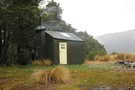
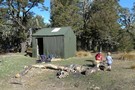
Boundary Creek Hut (Hakatere)
Hut
•
Basic Hut/Bivvy (DOC). Capacity: 8.
•
Distance: 9.0km away
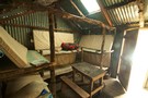
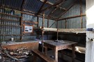
boundary creek hut has 8 bunks and a concrete floor, mattresses and open fire and its very own resident mice ...
More ▶︎
boundary creek hut
Photograph
•
Distance: 9.0km away
everyone likes a hot wash in the morning and with river water so close and a fire and billy why ...
More ▶︎
boundary creek hut
Photograph
•
Distance: 9.0km away
boundary creek hut in the distance walking up from the gorge
More ▶︎
Mt Somers Track (South Face)
Track
•
1 day. Easy/medium. Return by the same track.
•
Distance: 9.0km away
Woolshed Creek Hut - Rhyolite Ridge Track junction (4 km) Time: 2 hr. The route takes in dynamic scenery with ...
More ▶︎
Emerald Pools
Track
•
Easy. Return via same track.
•
Distance: 9.0km away
A pretty picnic area and swimming hole upstream from Pelorus Bridge.
More ▶︎
Mt Crichton Loop Track
Track
•
Easy. Loop track.
•
Distance: 9.0km away
Easy loop to an old mining area, with an historic hut.
More ▶︎
Boundary Creek Hut
Photograph
•
Distance: 9.0km away
A great little musterers hut in the Hakatere Conservation Park near the South Branch Asburton River.
More ▶︎
Dog Kennel Bivvy
Hut
•
Basic Hut/Bivvy (DOC).
•
Distance: 9.1km away
Basic hut, no bunks, dirt floor, but still good shelter. Fireplace outside.
More ▶︎
Cardrona Valley from near the Snow park
Photograph
•
Distance: 9.1km away
Our approach to the snow park from Cromwell using snowshoes over three days in august 2009
More ▶︎
Buzz Lightyear @ The Snow Farm
Photograph
•
Distance: 9.1km away
A bit of late season skiing for Buzz
More ▶︎

Buzz Lightyear @ The Snow Farm
Photograph
•
Distance: 9.1km away
A bit of late season cross country skiing for Buzz
More ▶︎
Breast Hill Circuit
Article
•
Distance: 9.1km away
Newish 2 day circuit on recently accessible pastoral land which we did in 4 days during a period of mediocre ...
More ▶︎
Pelorus Track (via Rocks hut & Totara saddle)
Track
•
2 – 3 days. Easy/medium. One way.
•
Distance: 9.2km away
The Pelorus track is a semi-remote forest experience in Mount Richmond Forest park.It leads up the Pelorus valley and over ...
More ▶︎
Mount Potts Station campsite
Campsite
•
Standard Campsite (Private).
•
Distance: 9.2km away
Powered and tent sites located on Mount Potts Station. The lodge also offers other accommodation, and a café/restaurant and bar.
Nearby ...
More ▶︎
Butterfly Creek
Photograph
•
Distance: 9.3km away
The pretty pool by the picnic area on Butterfly Creek.
More ▶︎
Butterfly Creek
Track
•
Easy. Loop track with a road section.
•
Distance: 9.3km away
An easy forest walk to a picnic area on the eastern side of Wellington Harbour.
More ▶︎
East Harbour Regional Park
Place
•
Place.
•
Distance: 9.3km away
Forest and wetlands on the eastern side of Wellington Harbour.
More ▶︎
Rocks Hut - Pelorus Track
Track
•
2 days. Easy. One way.
•
Distance: 9.3km away
Continuing on from the Dun Mountain track, this route drops into the Pelorus Valley and sidles above its beautiful river. ...
More ▶︎
Pelorus
Track
•
3 – 4 days. Easy. One way.
•
Distance: 9.3km away
Links with a track onto Dun Mountain. See Rocks Hut-Pelorus Track.
More ▶︎
Robert Ridge
Photograph
•
Distance: 9.3km away
looking NE along the ridge - in good weather, the views are expansive.
More ▶︎
Kapiti Island
Photograph
•
Distance: 9.3km away
Kapiti Island is the exposed remnant of an ancient mountain range. Sheer cliffs run the length of the northwestern side. ...
More ▶︎
Sharplin falls
Track
•
Easy/medium.
•
Distance: 9.4km away
Walk along a stream to the Sharplin Falls.
Different walks are possible.
More ▶︎
Sharplin falls
Photograph
•
Distance: 9.4km away
At the end of the walk to sharplin falls you'll find this.
More ▶︎
Robert Ridge in the Rain
Photograph
•
Distance: 9.4km away
On our last day, we decided to walk out from Speargrass Hut via Robert Ridge (to avoid retracing our walk ...
More ▶︎
Little Criffel Track
Track
•
1 day. Medium. Loop track with a road section.
•
Distance: 9.4km away
A steep track leading to Little Criffel (1341m), off the Cardrona Valley Road.
More ▶︎
Picton Harbour and Queen Charlotte Sound from the Tirohanga Walkway
Photograph
•
Distance: 9.4km away
A good view of inner Queen Charlotte Sound.
More ▶︎
Lower Wairaki Hut
Hut
•
Standard Hut (DOC). Capacity: 4.
•
Distance: 9.5km away
Biv at the edge of farmland on the Wairaki River.
More ▶︎
Breast Hill
Photograph
•
Distance: 9.5km away
Heading along the ridge from Breast Hill toward Stodys Hut (Hawea Conservation Area) in the late afternoon. Photo taken early ...
More ▶︎
Snout Track
GPX file
•
Distance: 9.5km away
A short walk near Picton with good views of Tōtaranui / Queen Charlotte Sound.
More ▶︎
Great Walks Information
Article
•
Distance: 9.5km away
The DOC Great Walks are a set of premium tramping tracks throughout New Zealand.
More ▶︎
Boundary Hut (Mavora- Greenstone Walkway)
Hut
•
Standard Hut (DOC). Capacity: 8.
•
Distance: 9.5km away
A hut on the Mavora-Greenstone Walkway on Mararoa River, beyond North Mavora Lake.
More ▶︎
Mt Bealey
Photograph
•
Distance: 9.6km away
Its my first walk. up Mt Bealey. Absolutly love being in the nature, So happy, So excited. My friend described ...
More ▶︎
Woolshed hut
Photograph
•
Distance: 9.6km away
One of two huts on the mount somers walkway and is more like a hotel than a hut.
More ▶︎
Mount Somers Track
Track
•
2 days. Easy/medium. One way.
•
Distance: 9.6km away
Leading around the back of Mount Somers, an ancient volcano, this track explores a fascinating landscape with handsome grasslands and ...
More ▶︎
Carrington Peak
Photograph
•
Distance: 9.7km away
Carrington Peak, Arthur's Pass, from near Carrington hut. taken February 2007
More ▶︎
What Is This ?
Photograph
•
Distance: 9.8km away
Fungi ? found on a fallen log on the ridge of the Hemi Matenga Reseve behind Waikanae. Hope somebody can ...
More ▶︎
Red Hills Ridge Traverse
GPX file
•
Distance: 9.8km away
Traverse of the Red Hills Ridge beginning from the Red Hills car park, returning via Mt Ellis, Hunters Hut, Porters ...
More ▶︎
Carlyle Hut
Hut
•
Basic Hut/Bivvy (DOC). Capacity: 8.
•
Distance: 9.8km away
Hut on Carlyle Stream, an obscure corner of Lake Sumner Conservation Park beneath the Poplars Range. Generally visited by hunters.
More ▶︎
Misty morning on Bealey Spur
Photograph
•
Distance: 9.8km away
Early morning drizzle releases its grip.
More ▶︎
Carrington Hut
Photograph
•
Distance: 9.8km away
A large wooden hut at the confluence of the Waimakariri and the White Rivers.
More ▶︎
Nelson Lakes double figure eight with a reverse twist
Article
•
Distance: 9.8km away
January 2008.
A seven day epic up and over Lake Angelus from Speargrass Hut, then up the Sabine River, over Waiau ...
More ▶︎
Bealey Spur Hut
Hut
•
Basic Hut/Bivvy (DOC). Capacity: 6.
•
Distance: 9.9km away
Historic 1925 musterers' hut on an easy grassy spur over the Waimakariri River.
Old basic hut built around 1925 by musterers ...
More ▶︎
Bealey Spur Hut - Oct 2011
Photograph
•
Distance: 9.9km away
Exterior shot of the Bealey Spur Hut in October 2011.
More ▶︎
bealey spur hut interior
Photograph
•
Distance: 9.9km away
a beech pole frame with 1930's corrugated iron, viewed from the door
More ▶︎
Nydia Walkway
Track
•
2 days. Easy/medium. One way.
•
Distance: 10.0km away
A shorter neighbour of the Queen Charlotte Track, The Nydia Track explores low saddles and shorelines in the Marlborough Sounds.
More ▶︎
NSTC plaque Rangitoto Island
Photograph
•
Distance: 10.0km away
NSTC plaque on anniversary seat on Rangitoto Island.
More ▶︎
NSTC seat Rangitoto Island
Photograph
•
Distance: 10.0km away
NSTC anniversary seat on Rangitoto Island.
More ▶︎